
Monday was a hot, hazy and humid hiking day with barely a breeze. We thought a short little hike wouldn’t that require much effort would be perfect for weather conditions like these. We were wrong, any hike in this type of weather requires an effort.
Our decision was made to hike Iron Mountain in Jackson NH. We had attempted this mountain, one fall, but when we drove up to the trail head there were no views, all socked in. As this is on the 52 With a VIew List we knew we wanted to wait till we had a chance to see the mountains that surround this one.
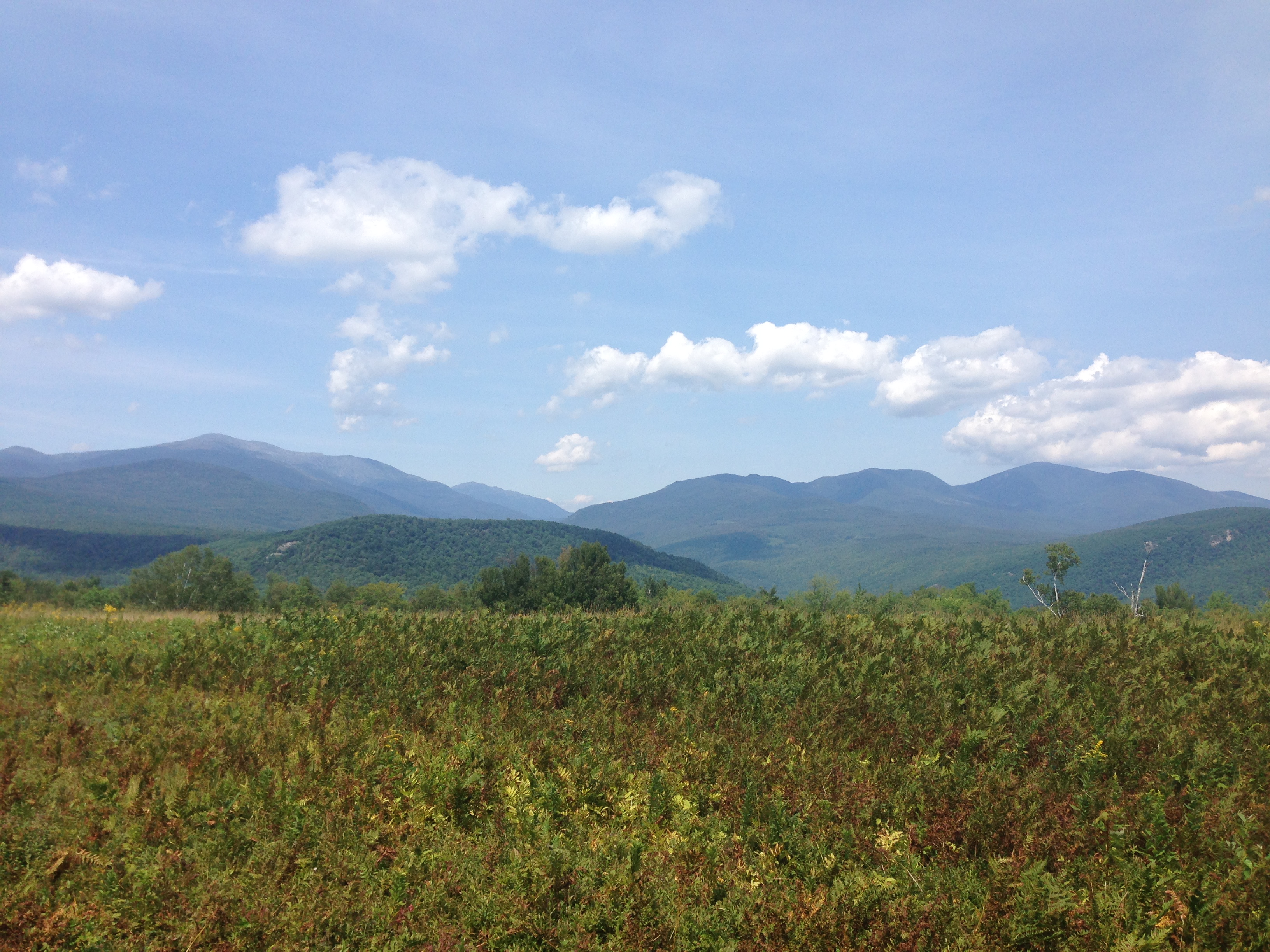
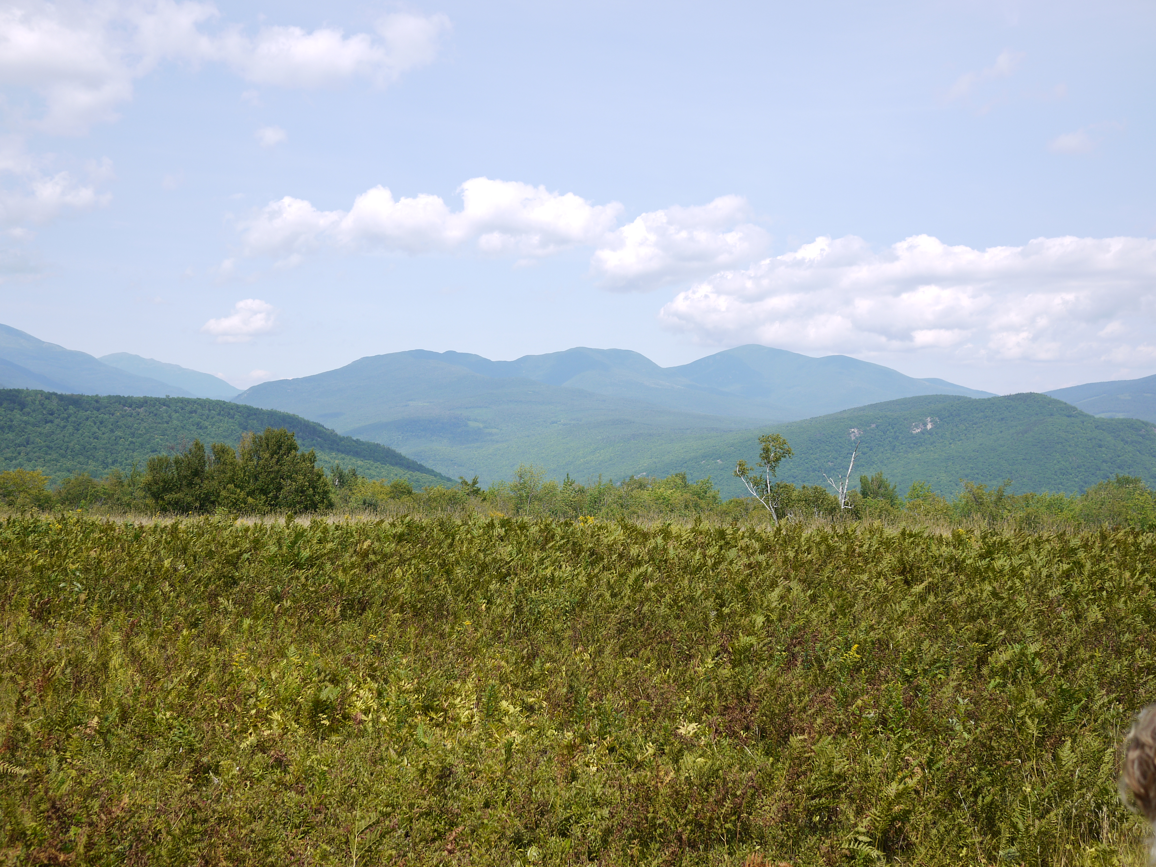
After parking below Hayes Farm, we started up the grassy hill.


I just kept thinking, as we walked this grassy bit, I would be happy here with just a bench, the views were so spectacular, even on a hazy day.

We entered the woods by the sign.

Into the woods we ambled for a short distance, then out on another grassy field and returned to the woods. At around .3 miles we began the climb up. Parts of this trail are eroded and I wouldn’t hike it right after we have a major rain storm.

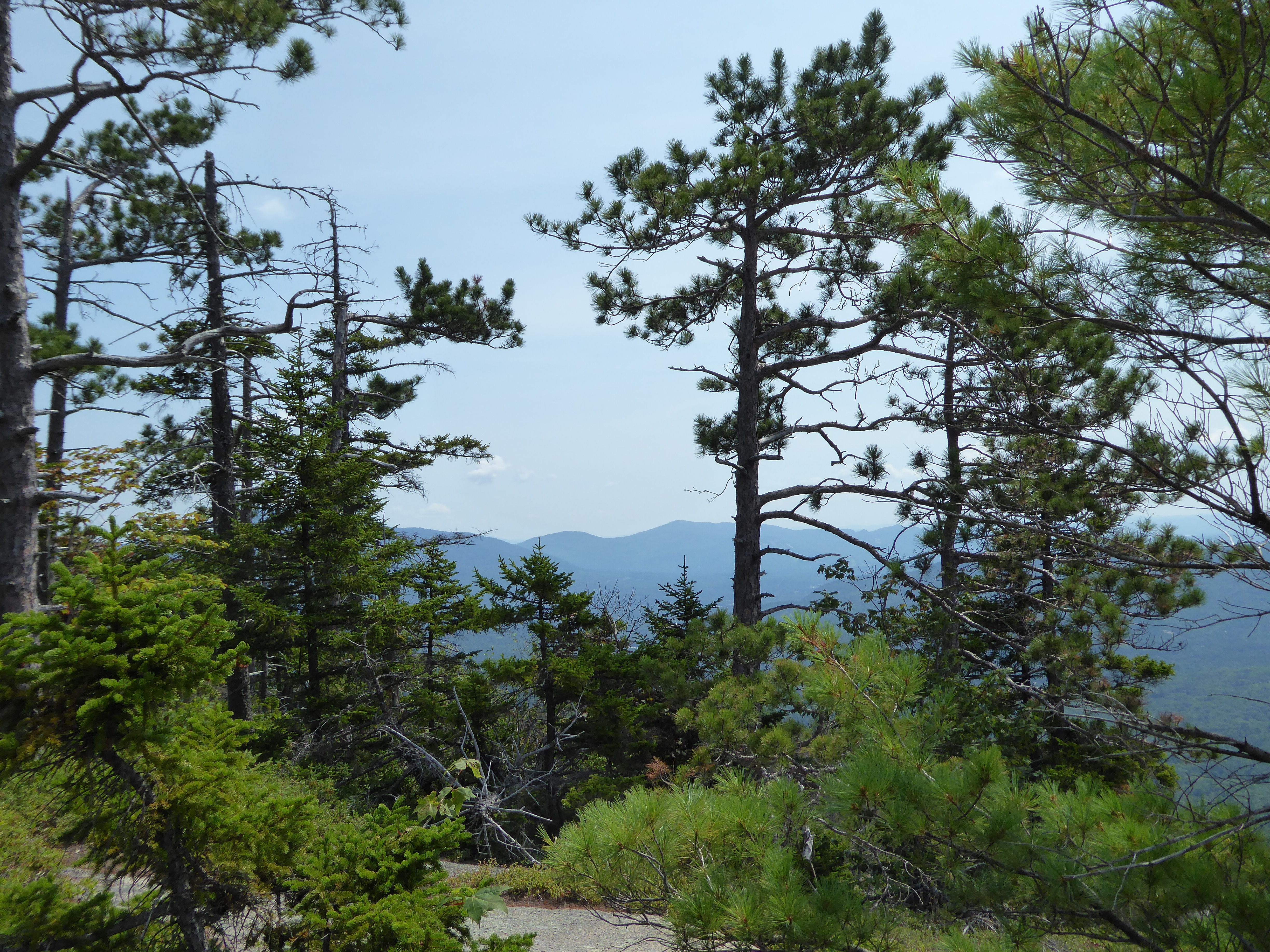
Due to the absence of a cooling breeze and humidity increasing, we didn’t snap a great amount of photos, we just wanted to keep going.
We did encounter one rock slab and coming up to it I thought, this might be long and arduous, however in true White Mountain style, nothing is as it appears to be. It was minor and easy.

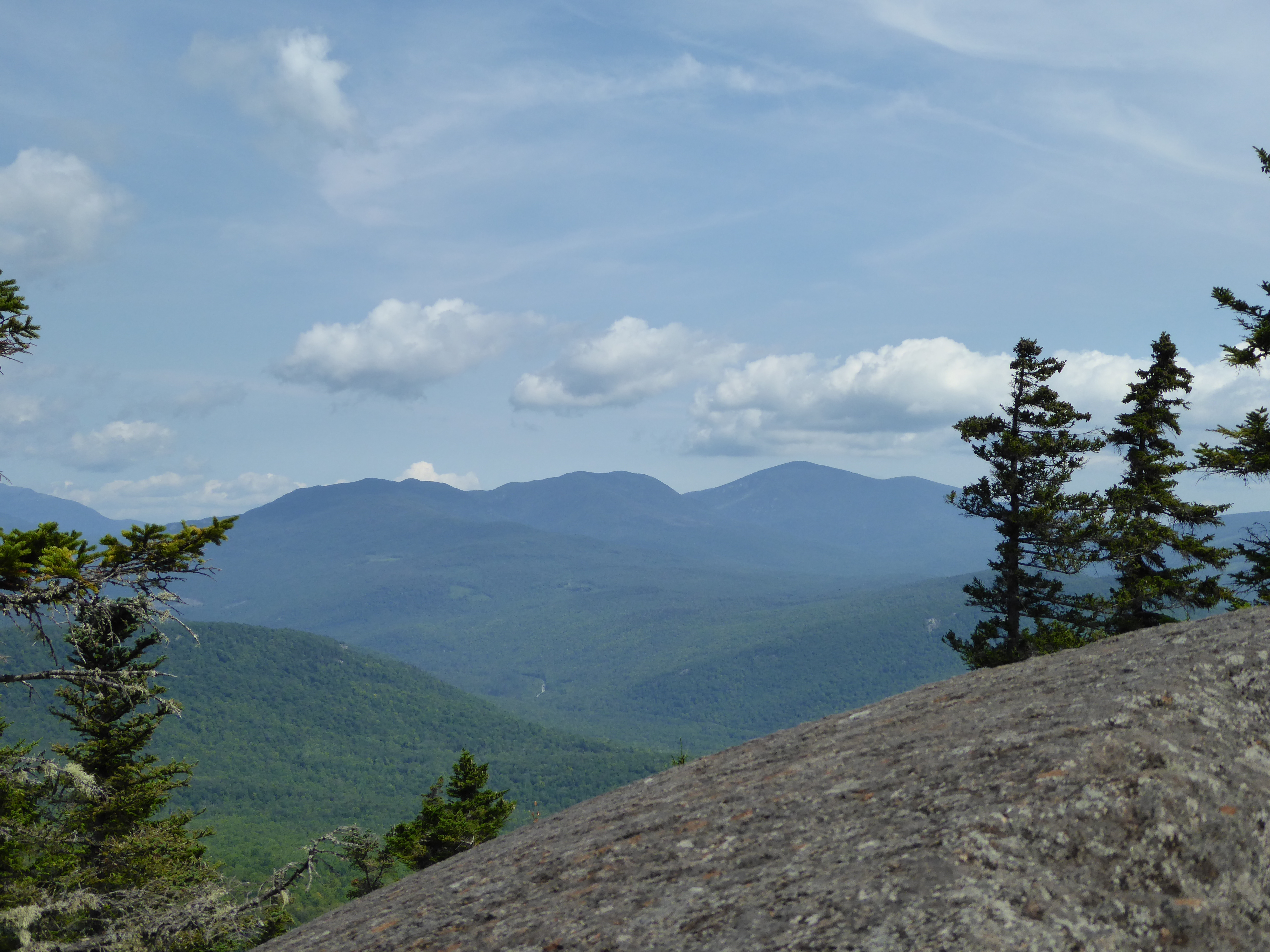
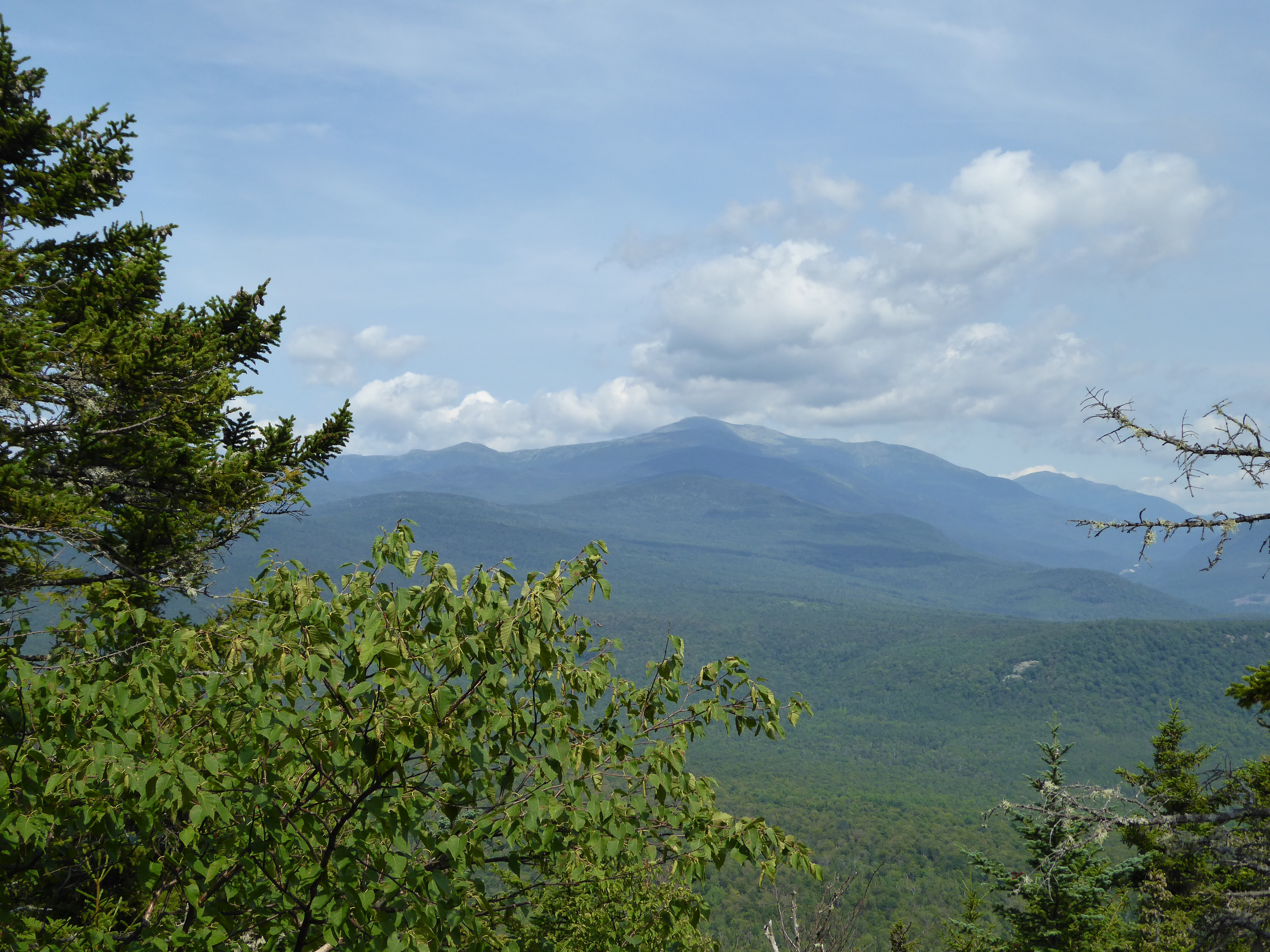
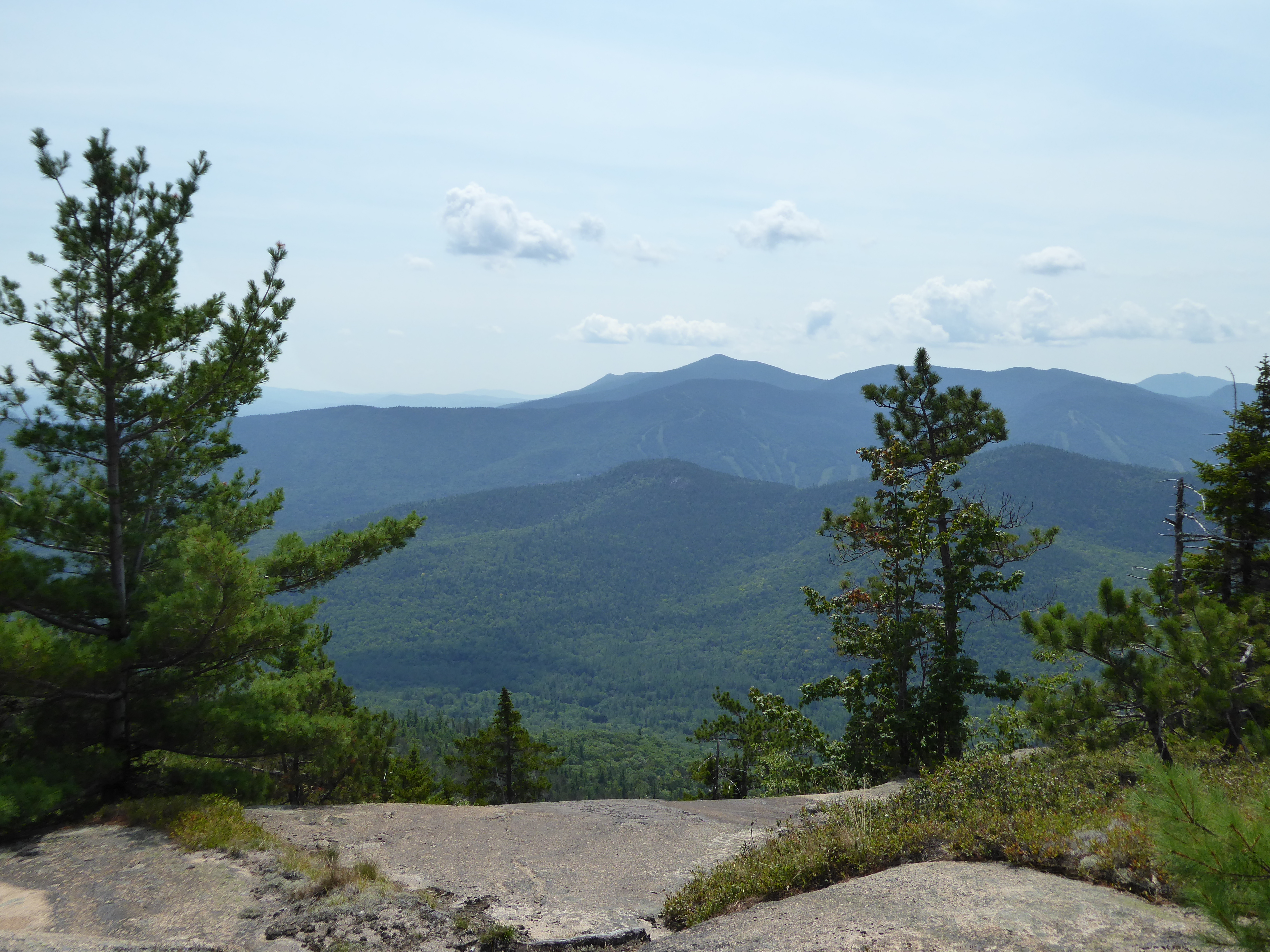
After this little section, we were treated to an outlook, about 20 yards off to the right. It granted us a fine view of the Presidentials.
In .3 miles from this view you summit Iron Mountain, where an old fire tower used to stand. This is a no view mountain.
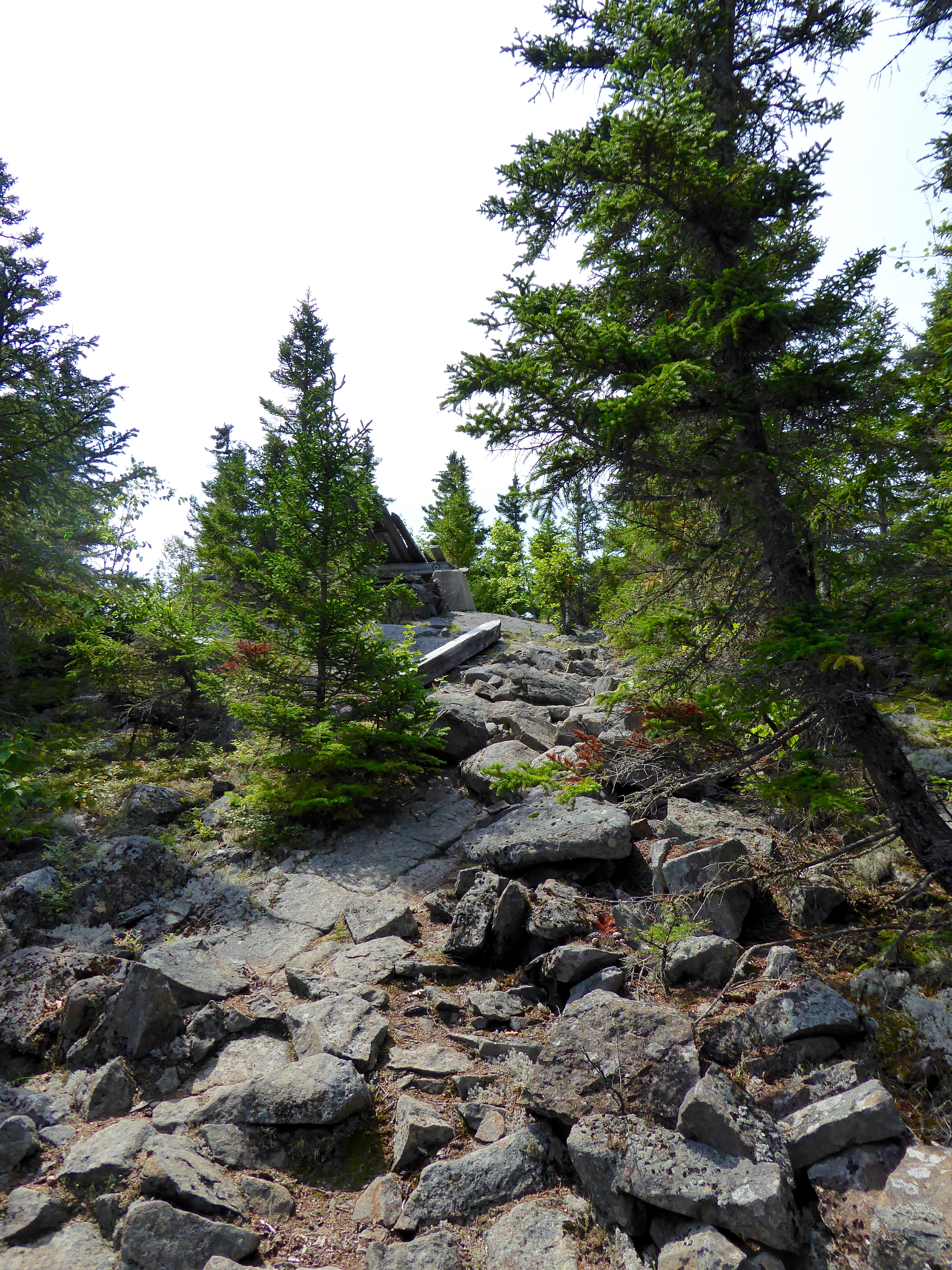


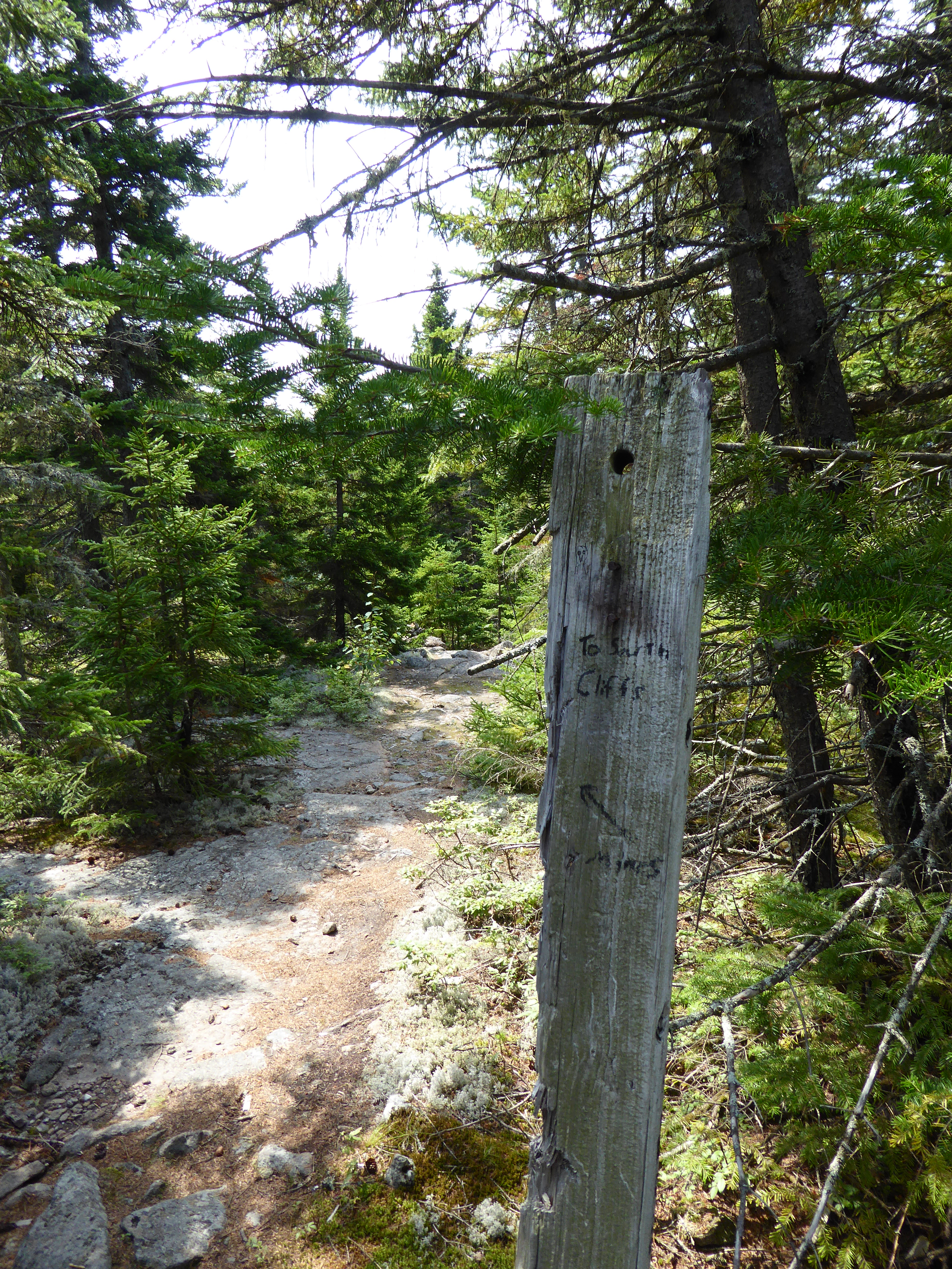
After briefly checking out the ruins, we scurried on the path to find the south cliffs, where the views were to found. The only sign denoting the path was this piece of wood. At this point, cairns helped to guide our way.
It was a descent to the cliffs with one steep section.


Around 1.5 miles the trails splits if you go to the left you are heading towards the mine. We met a man coming up from that area. He said he searched for the mine but couldn’t find it, so he abandoned his quest. We veered right to the cliffs. The views that awaited us were justified to be on 52 With a View List.


If wasn’t so darn hot, I think we would have easily spent an hour or two exploring all over the rock slab, just enjoying the views. We quickly retreated back to the woods, out of the blazing sun.

We quickly made it back to our car from the cliffs (only about 60 minutes). We briefly stopped twice on the descent. Once to chat with a man and his daughter who were going to try to find the cliffs (it was the man’s third attempt to reach them, signage is poor) and one more time to snap photos from the field.
After the hike we drove the short distance to The Sunrise Shack in Glen for a burger, salad and a brew. I would highly recommend this place for an after hike food stop.

It was a great little hike, one I would repeat in cooler weather and in the fall to see the colors displayed.
The Details: Around 3 miles, elevation gain of 1100 feet, 3 hours.


Leave a comment