I’ve been eyeing the Pisgah State Park for a few years. When we used to travel up to the White Mountains to babysit a friend’s cottage, our meander home to Connecticut would sometimes take us past this state park. I tucked the name away, thinking when our caretaking run was over, this was a mere 90 minute drive from home, doable as a day trip.
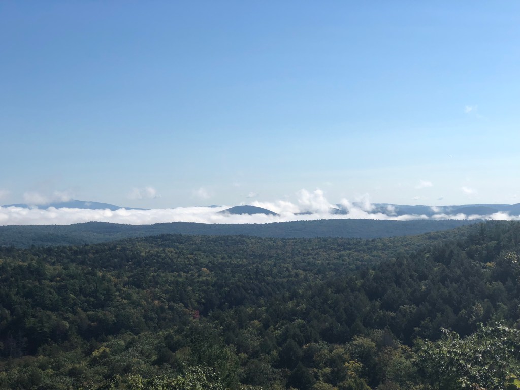
Well the gig is up as they say being caretakers of the cottage up north, time to finally hike this place and get some views in. As we drove through Pioneer Valley in Massachusetts, a fog settled in and we started to become nervous our views would just be clouds and fog. As usual our attitude was “oh well, at least we will get some miles in and enjoy the forest even more.” Well the hiking gods were with us today and as soon as we hit the road leading to the trailhead, the fog dissipated.
Our hike was focused on the Pisgah Mountain Loop, which really is a lollipop hike. We forgot our printed trail map at home, but luckily the trailhead kiosk supplied us with one. Though the one at home was much easier to read and gives a great description of what you will see on the hike, we made due with the one offered at the kiosk.
The repeat part of the hike started on Kilburn Road.


Throughout the hike we would encounter areas of webs, for me it looked like woodland fairies had dropped in to decorate for a party.

Right before we reach Pisgah Mountain Trail, I took a side shoot trail to look at Kilburn Pond. You can do a five-mile loop around Kilburn Pond here also.


Then we crossed a few bridges throughout this hike (warning they were wet and very slippery), we remained on the Pisgah Mt. Trail till we hit the Pisgah Ridge Trail, where we went right.


The red salamanders were very active on the trail, requiring us to have some fancy footwork at times, to avoid stepping on them while they congregated in the middle of the path.

The Pisgah Ridge Trail had a steady climb up to Pisgah Mountain with views out to Mt. Monadnock in the east and a porcupine eating a mid morning meal in the trees (sorry, can’t promise you will get the porcupine view).


We followed the trail to the next viewpoint which overlooks Pisgah Reservoir.


Our next trail junction we took was Reservoir Trail north, then a left on Baker Pond Trail. Of course, we had to have our peanut butter and jelly sandwich while walking.


The next junction brought us back to the Pisgah Ridge Trail, taking it for about a mile that included more scenic vistas to enjoy.


After the mile we had a descent until we returned to the Pisgah Mountain Trail to hike back to the car.


On our way home we stopped in Greenfield, Ma for lunch and a beer at The People’s Pint, while we enjoyed the nourishment, the bartender told us about a new ice cream shop that had opened up down the street. Of course had to try out the ice cream, enjoying a cup of Avocado Coconut, which capped off a rather great day.


The Details: 9 miles, 4 hours, elevation of 1200 feet.


Leave a comment